

Antarctic Meteo-Climatological Observatory
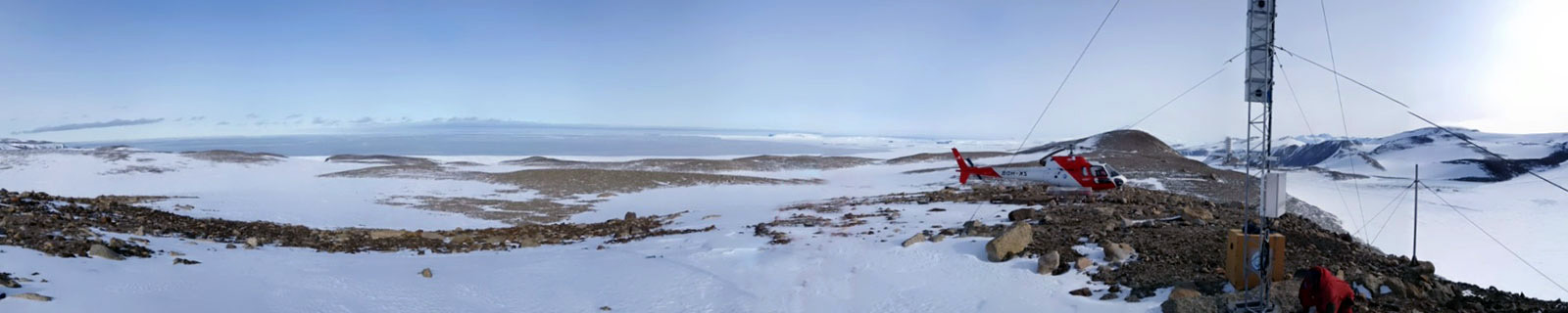 Instruments -> AWS


| Latitude | 74° 43' 30'' S |
| Longitude | 164° 1' 59'' E |
| Altitude | 268 m |
| Installed on | 5 January 1993 |

Location
A small lake, permanent ice covering, in the northern foothills between Boulderclay Glacier and Gerlache Inlet. Located 5km East of Mt Abbott and 3.5km SW of Mario Zucchelli Station. Feature discovered and named by Trevor Chinn in 1982. Descriptively named for the enigmatic area of sediment on the ice of the lake centre.
(From http://www.scar.org/)
Data sheet
Model: Vaisala Milos 520
Mast: 10 m
- Wind Speed and Direction
- Temperature and Relative Humidity
- Atmospheric Pressure
- 1 FLASH 4 MB
- 6 batteries. Tot 900 Ah
- 2 solar panels
- Argos satellite
Curiosities ...
Max Wind speed: 135.0 knots (250 Km/h) at 15 June 2012
Minimum temperature: -40.7 °C at 21 July 2004
Maximum temperature: 9.6 °C at 11 January 2002