Did you know ...
All weather stations being located in remote places are powered with batteries.
Five AWS belong to the WMO network and contribute to the world's weather forecasts.


 Instruments -> AWS

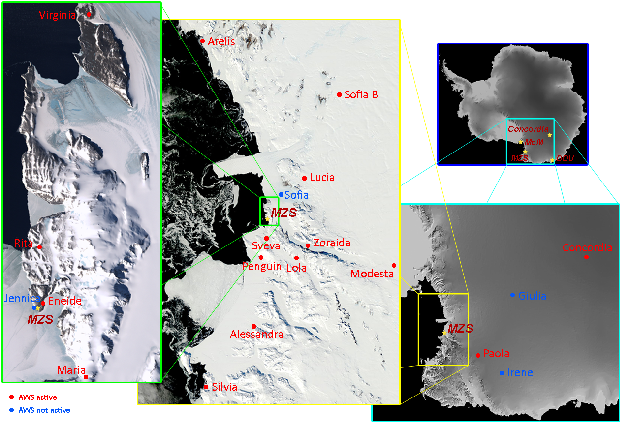
Currently the Observatory manages 20 AWS located over the region of Victoria Land and the Antarctic Plateau. 16 AWS are permanent and mainly used for scientific purposes, while the other 6 are used as support of flight operations and they are mounted only during the summer campaign.
Most of the AWSs are constituted by acquisition and control units provided by VAISALA. Stations dedicated to scientific activities and one amongst those for flight operations measure atmospheric pressure (hPa), temperature (°C), relative humidity with respect to water (%), speed (knt) and wind direction (°); the sampling frequency can be set depending on the period of the year and the type of use. the other airstrip stations measure only the wind field.
AWS store data on removable memory cards that facilitate maintenance. In addition, 12 stations transmit data via the satellite network Advanced Research and Global Observation Satellite (ARGOS) to Italy and to the Italian Antarctic Stations allowing remote monitoring of their status and data. Moreover, all the AWS dedicated to flight control activities are connected via radio to the operation room of the Mario Zucchelli Station to allow continuous monitoring of the area.
In the table below is reported for each AWS the operating period. Click the link above to access to detailed information of each station and site (characteristics, instrumentation, measurements carried out and communication protocol).
All weather stations being located in remote places are powered with batteries.
Five AWS belong to the WMO network and contribute to the world's weather forecasts.
In June 2012, the AWS Rita, at Enigma Lake, measured a wind speed of 135 knots (250 km/h).
In August 2010, the AWS Concordia, at Dome C, measured a temperature of -84.7 °C.